

There are no comments for this product
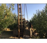
By conducting geophysical studies or underground water scanning, you can determine the exact depth and exact point for drilling and get the best result with the lowest cost and avoid wasting funds by getting better results. Before drilling a well, breaking the bottom or moving a well, contact us: 09353351942 Mr. Aghaei Engineer - Caspian Exploration Company Providing services all over the country 09353351942 Engineer Aghaei - Caspian Exploration Company With more than 380 deep well exploration and drilling projects and 600 successful semi-deep well projects and registration and discovery of mines in different regions of the country.
Our pride is customer satisfaction. Has approvals from government bodies regarding geophysical and geotechnical works The Deep Finder Apollo radar detector with a range of 5 kilometers and a depth of 100 to 450 meters, a joint product of England and Japan, together with an automatic geological device IRIS model of France SYSCAL, with the power of subsurface imaging and scanning to a depth of 400 meters, without operator intervention, the possibility of locating, determining the best location And it provides and measures the depth of drilling the well with the highest water potential, tracing the path of the aqueduct, the spring and the water escape places of the dams and the depth of the bedrock, determining the water quality and estimating the amount of water with very high accuracy. Tracking, identifying and discovering underground water with the above devices has a much higher accuracy and speed than other traditional and old methods (more than 95% accuracy). Guarantee the accuracy of exploration with free well drilling and paying the drilling fee after obtaining the result. The exclusive method to find the exact drilling point is to first explore the entire land with a radar scanning device that uses infrasound waves under a specific frequency, both in the air and on the ground.