

There are no comments for this product

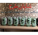
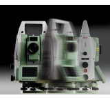
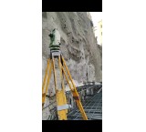
Perform all surveying services across parts of the country, using technology which at least high precision for maps-image vertical from the region-a three dimensional model of the project in the following applications:
_تهیه map, plan, rural, etc. designs detailed and comprehensive urban
_تهیه topographic maps
_تهیه of cadastral maps in order to possession of lands
_مطالعات different projects, grid ... railway, water and wastewater, transmission lines, energy, telecommunications and oil and gas pipelines
_مطالعات forests and meadows, and agricultural lands
| Company | سپهر |
|---|---|
| Tel | +98 -0×××0229351 |
| Mobile | +98 936×××9351 |
| Country | Iran |
| Province | Esfahan |